Location data
QUICK LOCATION PATH: Utah / Salt
Lake County / Big Cottonwood District / Big Cottonwood Canyon / Mill A Gulch (North)
|
Approximate GPS Location:
|
40.38.930 N - 111.41.416 W (plat estimate) |
|
|
Approximate Elevation:
|
8226' (plat estimate)
|
|
|
30 x 60 Minute Map:
|
SALT LAKE CITY, UTAH
|
|
|
7.5 Minute Map:
|
MOUNT AIRE, UTAH
|
|
Mineral Survey Plat
Below is a copy of the Mineral Survey Plat for the Amanda Lode Mining
Claim, Big Cottonwood Mining District, Mineral District #5, Mineral Survey #63, Lot #99, dated June 13, 1878. The original
claim was 600 feet wide, and 1500 feet long, running South-East to North-West and encompassing 20.66 acres of ground.
The Plat shows the discovery marker at the south central portion of the claim on the west
slope of Mill A Gulch (North) above the Maxfield Claim. At the time of the survey, the Amanda was worked at two different
locations, both tunnels. The longer of the two, the Adelaide at 200 feet, and the shorter, the namesake of the claim, the
Amanda, at 120 feet.
According to
the plat, a "rock cabin" 10 x 12 feet was also present on the claim just above the tunnels.
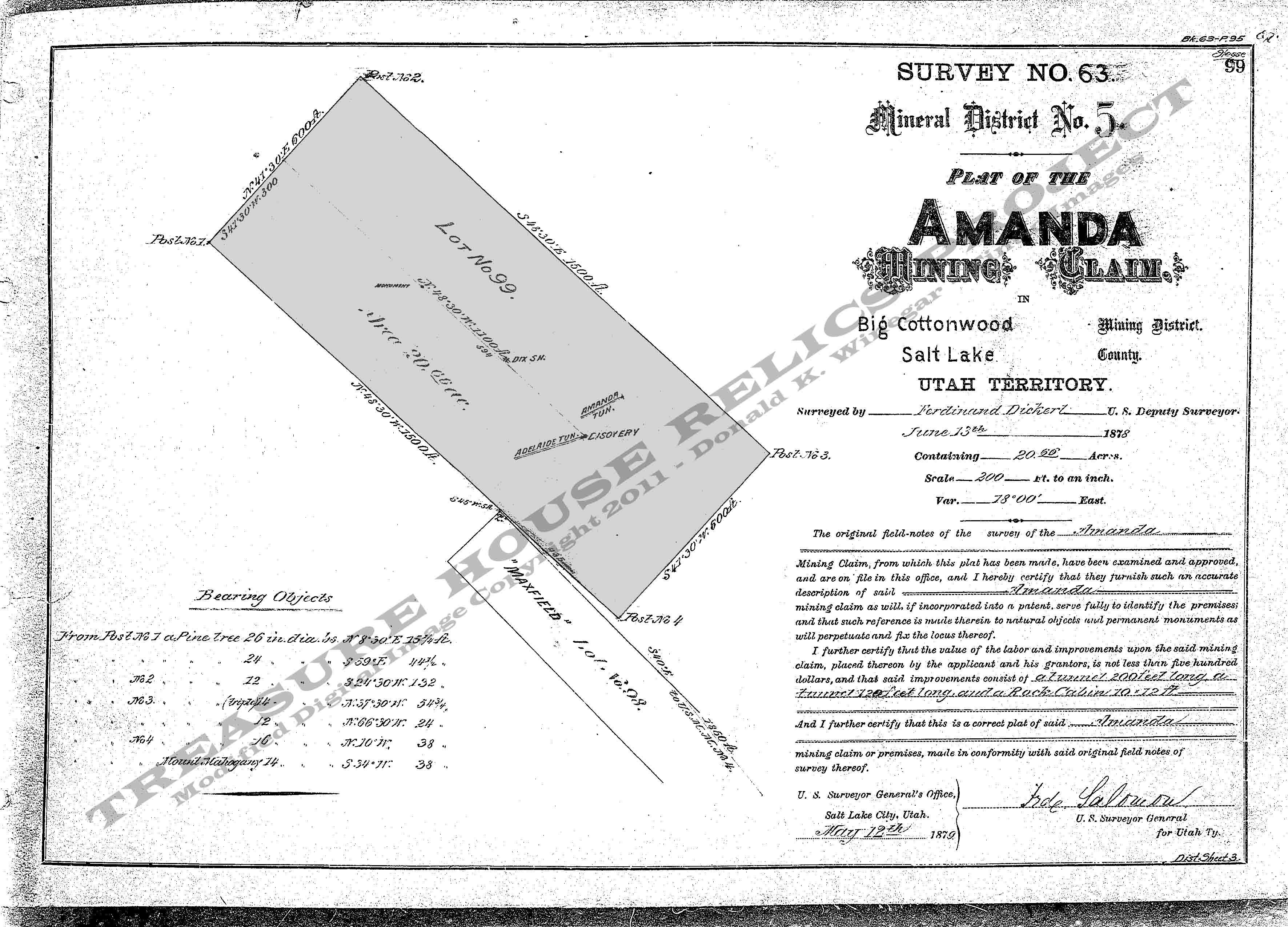
Base Plat is from original scans by the U.S. Department of the Interior, Bureau of Land Management (BLM).
Modified
digital map image Copyright 2011 - THRP - Tintic Images
What remains
Nothing. No structures remain standing at this site. Only water flowing from
the caved portal of the lower tunnel marks the site of the old Maxfield along the highway. Farther up the gulch to the left, small dumps from
several other prospect holes and the original shaft (also caved) can be found.
_____________________
