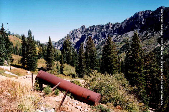
The Baby Mckee mine in upper South Fork looking north. c.1900
THRP Archives - Winegar Collection - All Rights
Reserved
Same view as above in the summer of 2004 with nothing left but the
dump, the boiler and some broken bricks.
Copyright
2004 - Donald Winegar - Tintic Images - All Rights Reserved
Location data
QUICK LOCATION PATH: Utah / Salt
Lake County / Big Cottonwood District / Mill D or South Fork or Cardiff Fork / Upper fork / west bowl
|
Approximate GPS Location:
|
40.36.283 N - 111.39.532 W (field) |
|
|
Approximate Elevation:
|
9169' (field)
|
|
|
30 x 60 Minute Map:
|
SALT LAKE CITY, UTAH
|
|
|
7.5 Minute Map:
|
DROMEDARY PEAK, UTAH
|
|
Mineral Survey Plat
Below is a copy of the Consolidated Mineral Survey Plat for the Baby
McKee, Leo, Evarena, and No.1 Extension of Evarena Lode Mining Claims, Big Cottonwood Mining District, Mineral Survey #144,
Lot #180, dated September 12-14, 1890.
The
original claim was 600 feet wide, and 1500 feet long, and ran in a South-West to North-East direction. The Plat shows the
discovery markers on each claim, but no other details of the site are shown. The consolidated claims, in line, one to another,
covered roughly 600 feet in width, and nearly 5500 feet in length, some 73.5 acres in total.
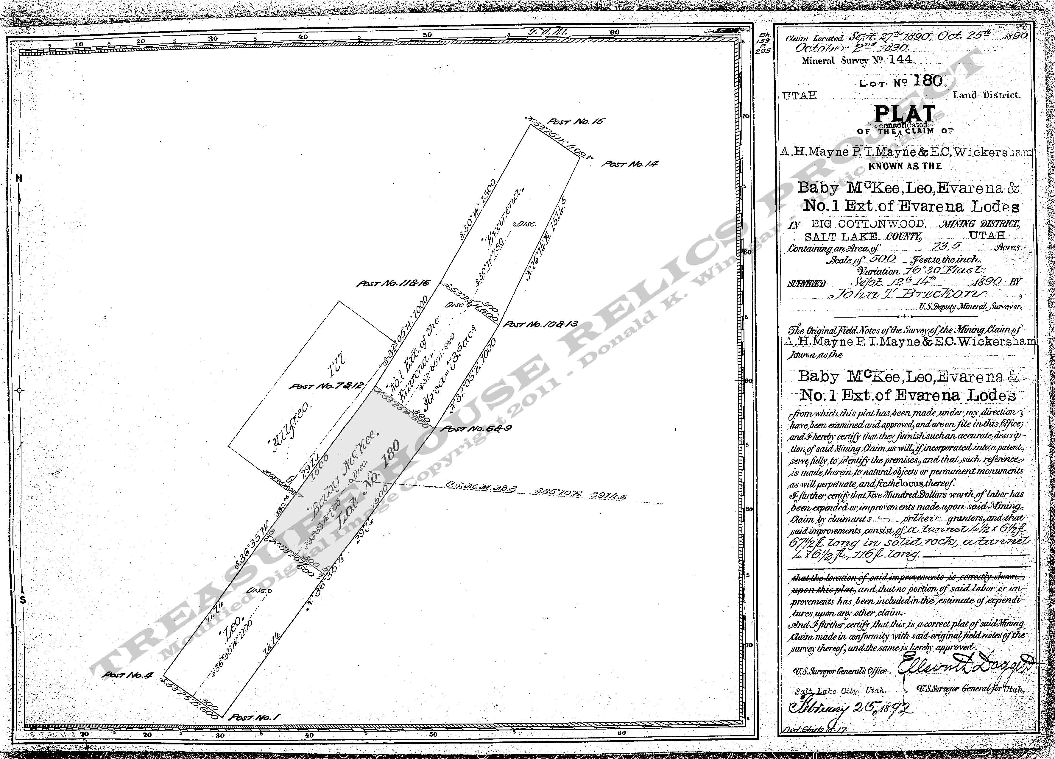
Base Plat is from original scans by the U.S. Department of the Interior, Bureau of Land Management (BLM).
Modified
digital map image Copyright 2011 - THRP - Tintic Images - All Rights Reserved