Antelope Mining Claim - BCC
Brief history
The Antelope was one of the earliest properties in Big Cottonwood Canyon. It was rich in ore, and output in the
early days, substantial. Just how much is not known. Adjacent to the Prince of Wales, output and production was usually included
with numbers from the larger and richer neighbor.
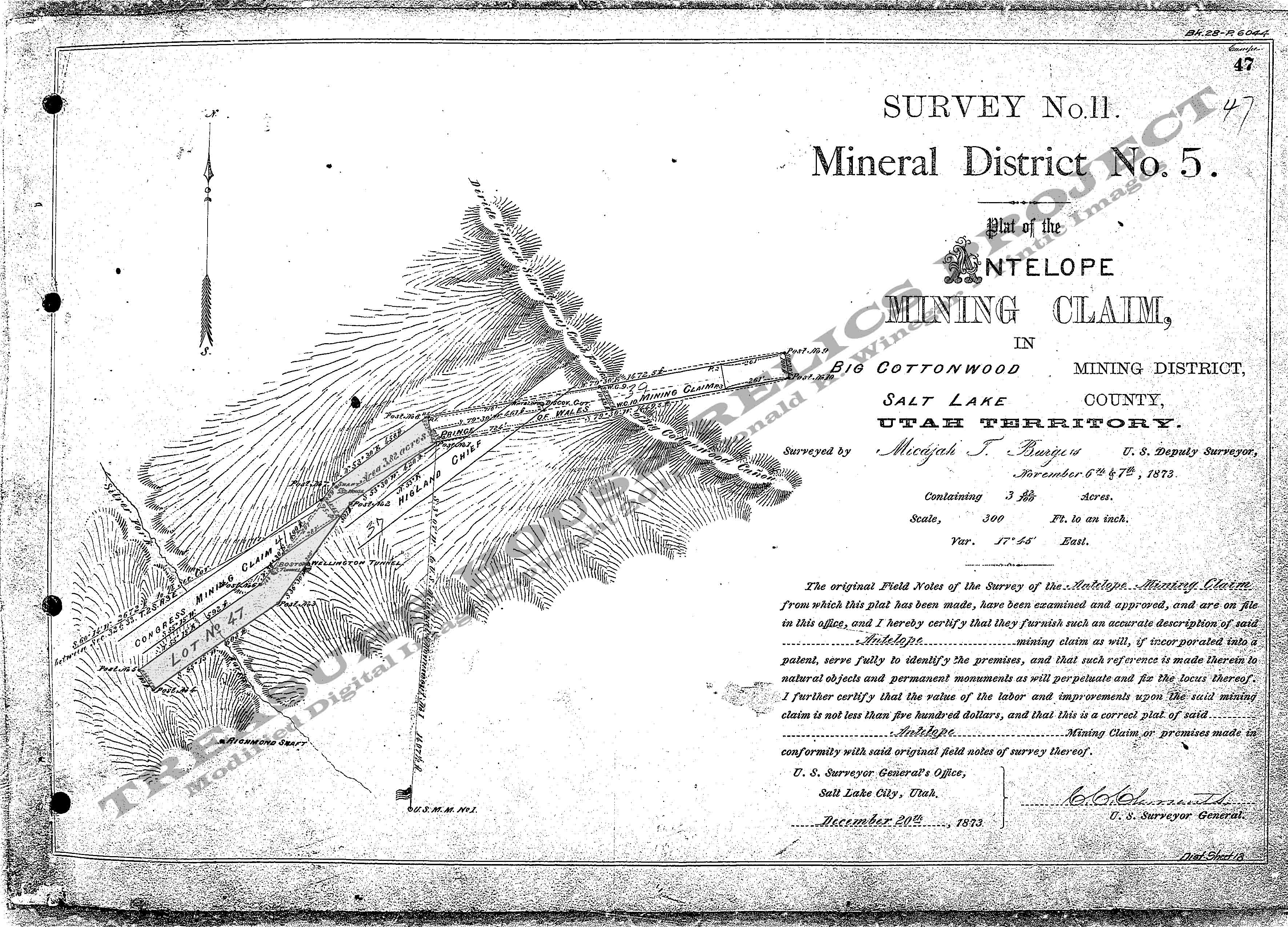
Mineral Survey Plat
Below is a copy of the Mineral Survey Plat for the Antelope Mining
Claim, Silver Fork, Big Cottonwood Mining District, Mineral District #5, Survey #11, Lot #47, Dated November 6 & 7th,
1873.
The original
claim was roughly 100 feet wide and just over 1500 feet long. A portion of the claim was on the south side of the creek but
mostly it was located on the north slope. It did not run in a straight line, but skewed to the left and then back to the right
as it rose in elevation. The claim ran from south-west to north-east and encompassed 3.82 acres of ground.
The Discovery shaft was located
near the upper portion of the claim, and a shaft house is noted as one of the structures present at the time of the survey.
No other structure information is given.
Base Plat is from originals scans by the U.S. Department of the Interior, Bureau of Land Management (BLM).
Modified
digital map image Copyright 2011 - THRP - Tintic Images
What remains
A few buildings
once sat near the old shaft, but have long ago disappeared.
More information
on the Antelope will be added in the future.
_____________________
