TREASURE HOUSE RELICS Project
Mercur
MERCUR_CANNON_BOOK_Utah_and_her_people_1899_emboss_crop.jpg

View of Mercur from Cannon's "Utah and Her People" c.1899 - THRP Winegar Collection - Tintic Images


Approx. G.P.S. Location:

40.19.252 N - 112.12.629 W  (topo)


Approx. Elevation:

6701'  (topo)


30 x 60 Minute Map:

Utah


7.5 Minute Map:

Mercur, Utah


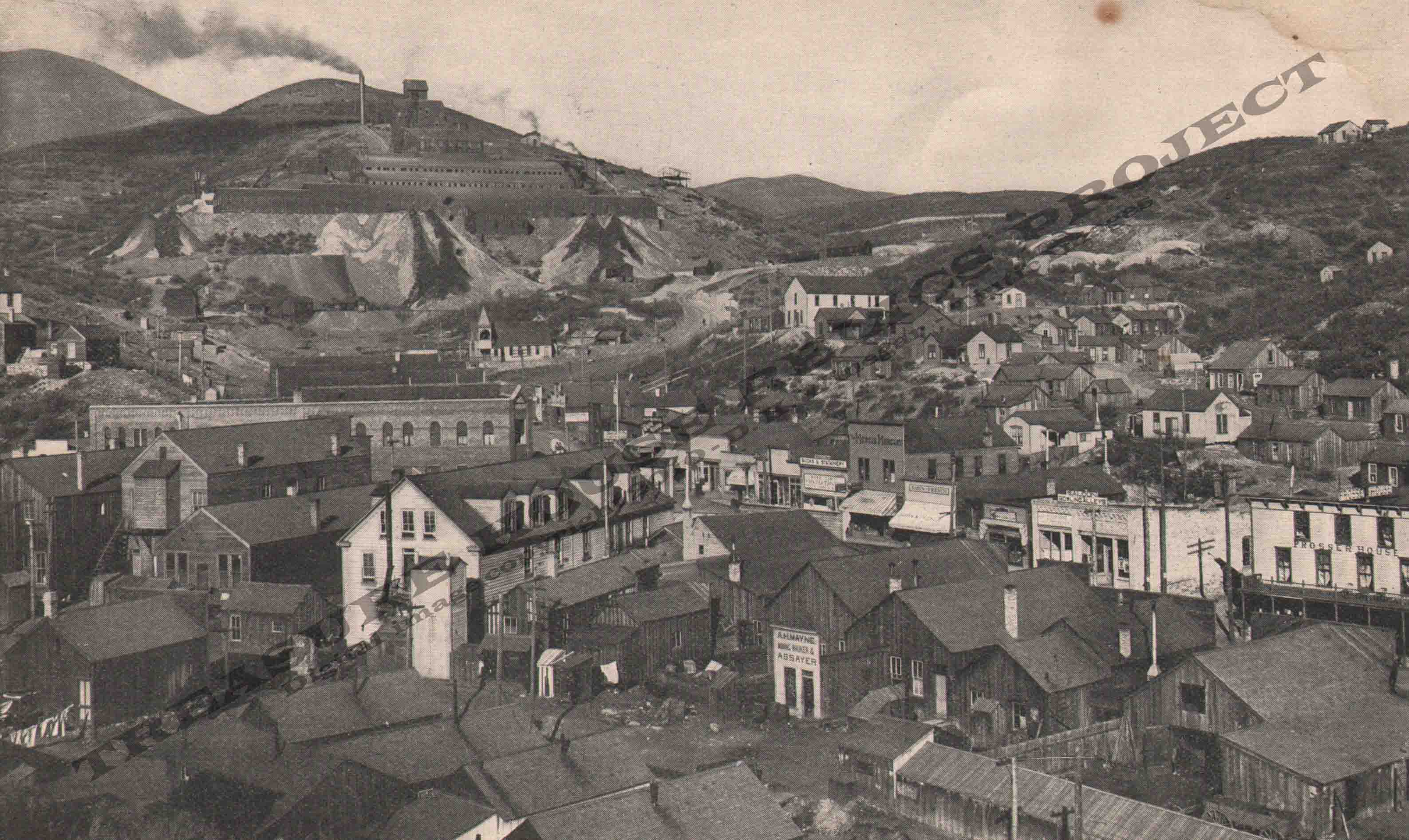
MERCUR VIEW looking SE c.1898
MERCUR_VIEW_looking_SE_MERCUR_JOA_BOOKLET_1898_p2_400_EMBOSS_crop.jpg

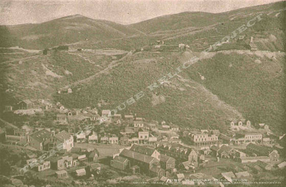
View of Mercur and the mines above looking SSE c.1898 - THRP Winegar Collection


At this time the entire area around the site of Mercur is closed to the public. Mining operations have ceased, and reclaimation work is now under way. It is believed that it will be open to the public at some time in the future. When that may happen is unknown.
 
It is believed that the only relic from the early mining days will be the stone foundations of the old Golden Gate Mill. (It was placed on the National Register of Historic Places many years ago.) What if anything else will remain is also unknown.

MERCUR_LOOKING_NORTH_MERCUR_JOA_BOOKLET_1898_p42_400_EMBOSS_crop.jpg
LOOKING_EAST_from_MARION_HILL_MERCUR_JOA_BOOKLET_1898_p6_400_EMBOSS_crop.jpg

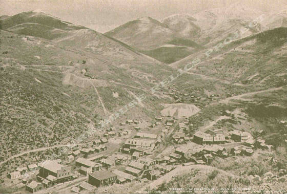
Looking East from Marion Hill, a portion of the town at bottom center, Wonder Mine & East Golden Gate Mines in the distance. c.1898
 

MERCUR_MILL_INTERIOR_MERCUR_JOA_BOOKLET_1898_p32_400_EMBOSS_crop.jpg
MERCUR_MILL_INTERIOR_MERCUR_JOA_BOOKLET_1898_p34_400_EMBOSS_crop.jpg
EUREKA_MILL_MERCUR_JOA_BOOKLET_1898_p44_EMBOSS_crop.jpg

_____________________