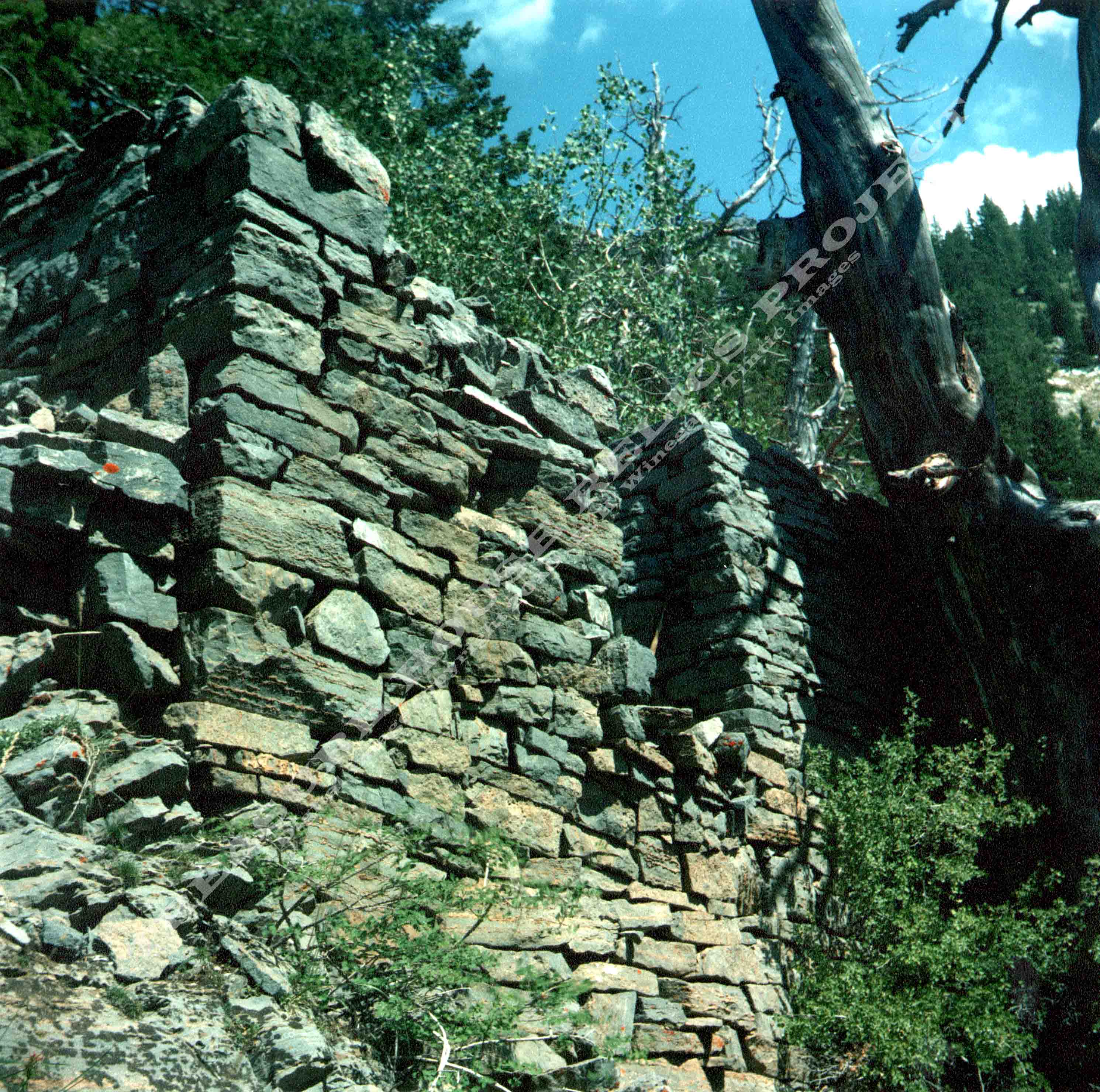
Stone
wall remains at the Silver Mountain Mine high on the west face of Kessler Peak c.2004
Martin McGregor Photo - Digital image - Tintic Images
Location data
QUICK LOCATION PATH: Utah / Salt
Lake County / Big Cottonwood District / Big Cottonwood Canyon / Mineral Fork / East or Silver Mountain draw
|
Approximate GPS Location:
|
40.37.436 N - 111.40.534 W (topo) |
|
|
Approximate Elevation:
|
9121' (topo)
|
|
|
30 x 60 Minute Map:
|
SALT LAKE CITY, UTAH
|
|
|
7.5 Minute Map:
|
DROMEDARY PEAK, UTAH
|
|
Mineral Survey Plat
Below is a copy of the Mineral Survey Map or Plot for the Silver Mountain
Lode #2 Mining Claim, Big Cottonwood Mining District, Mineral District #5, Survey #47, Lot #83, Dated November 3rd, 1877.
The original claim covered some 7.35 acres. The claim was 200 feet wide, and 1600 feet long,
and ran in a North-South direction. The Plat shows the discovery marker about center on the claim, a shaft of unknown depth
and a tunnel some 80 feet into the mountain. The plat also shows a cabin in place at the time of the survey about 50 feet
west of the discovery marker.
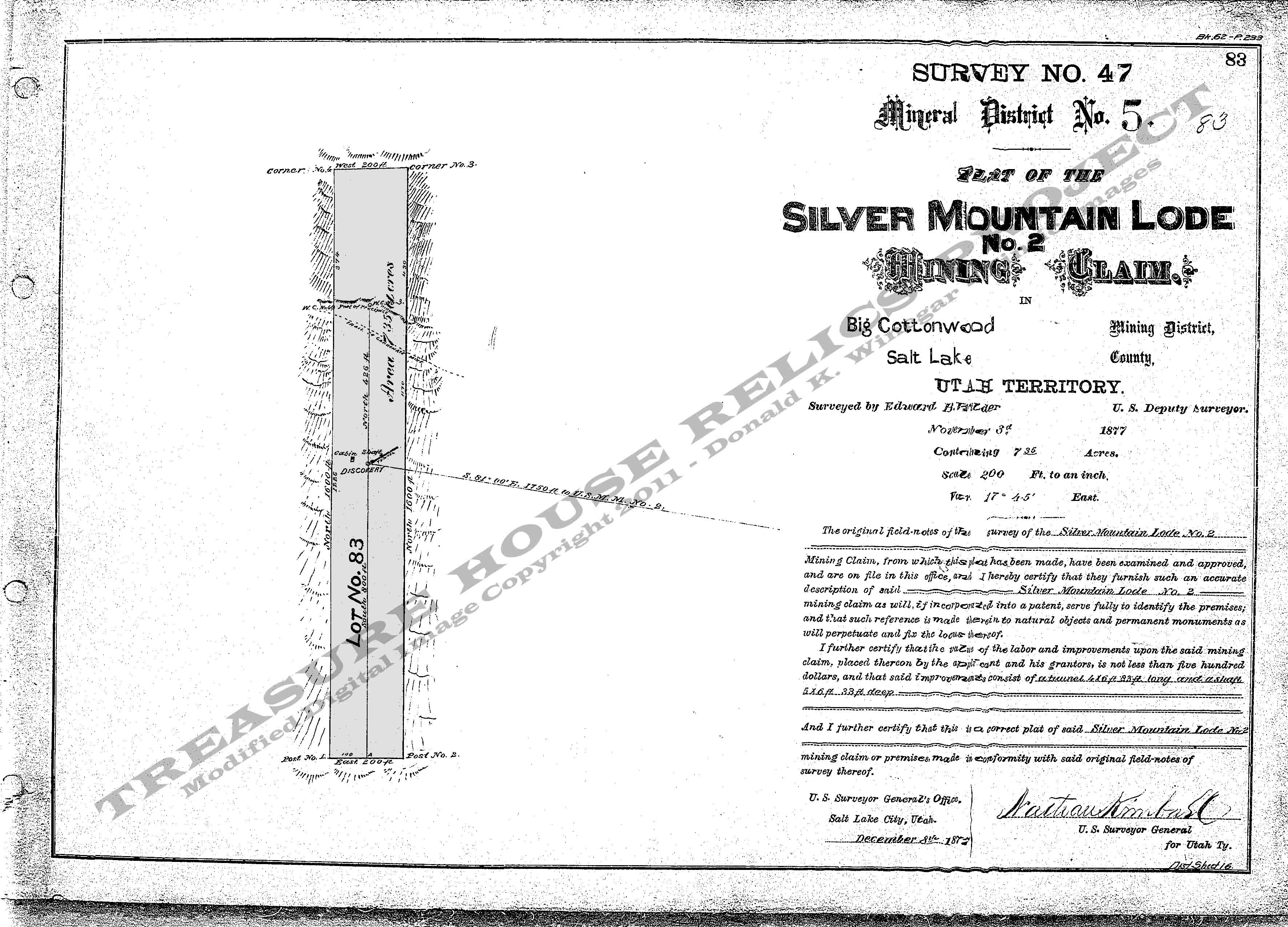
Base Plat is from original scans by the U.S. Department of the Interior, Bureau of Land Management (BLM).
Modified
digital map image Copyright 2011 - THRP - Tintic Images
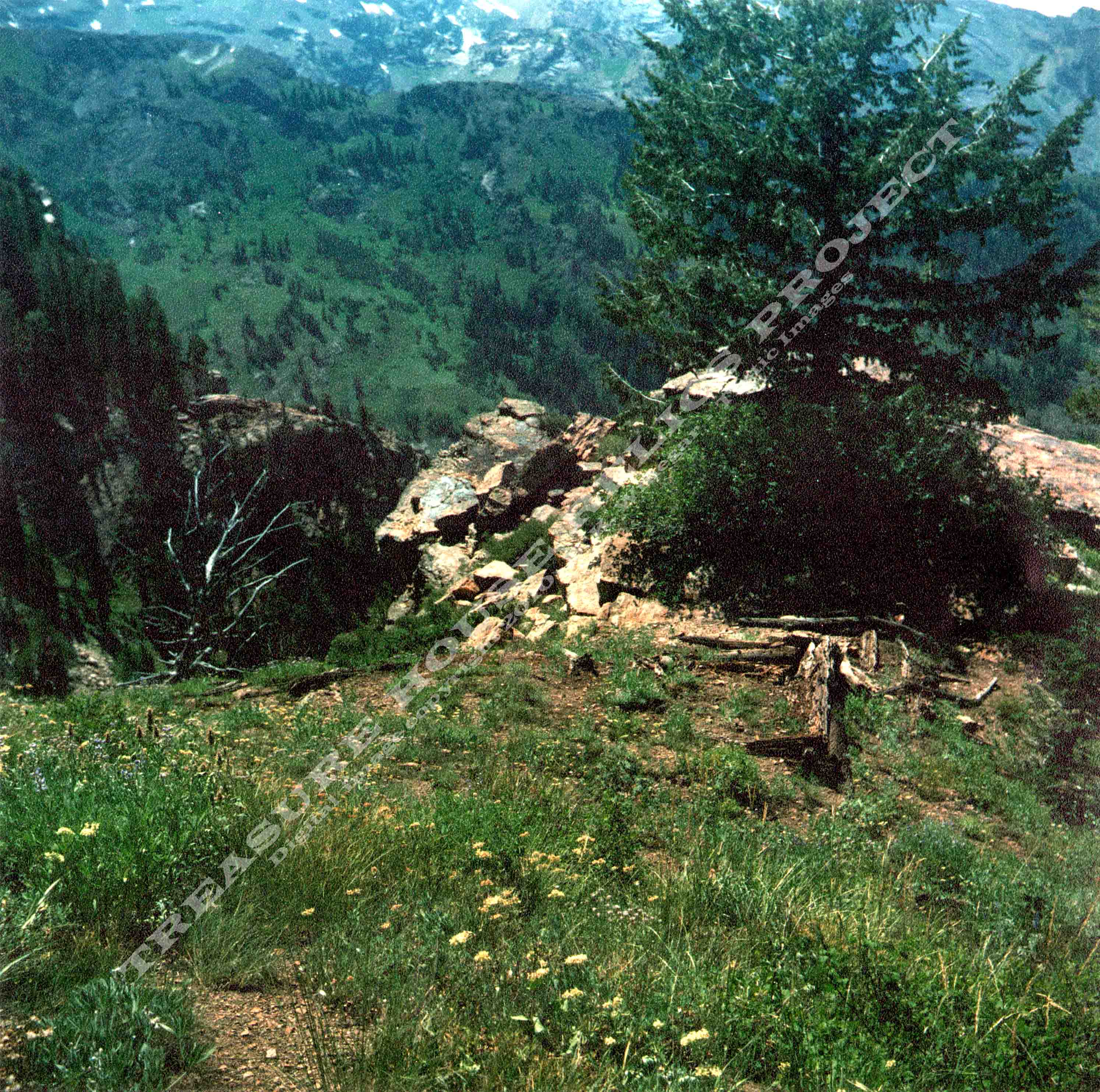
What remains
Heavy stone walls that once were a cabin or bunkhouse at the mine. Rotted logs from a second
smaller building, the partially caved portal, and the large dump that flows down the hillside hundreds of feet. Large enough
to see from the Salt Lake Valley if you know where to look.
View from above the cabin remains looking down into Mineral Fork c.2005
Martin McGregor Photo - Digital image copyright - Tintic Images
_____________________