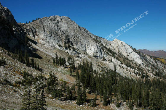
View of a portion of the Honeycomb Cliffs at the head of Honeycomb
Fork. View is looking north-west from the saddle with Mill F Fork just above the Black Bess Mine.- c.2005 Donald
K. Winegar - Tintic Images
Brief Description
Honecomb Fork is an east branch of Silver Fork that divides from that
canyon just above the present day summer home area. After dividing, the canyon rises sharply and turns to the south paralleling
South Fork, until it terminates in a U-shaped bowl just below a sheer rock wall known as the Honecomb Cliffs.
Several workings of note were found in this canyon, chiefly, Black Bess, Scotia, Copper Tunnel
and Annie Tunnel from the early days, the Woodlawn from the later days. Other than dumps, the Woodlawn is the only site that
remains with any portion of structures that are recognizable as one-time buildings.
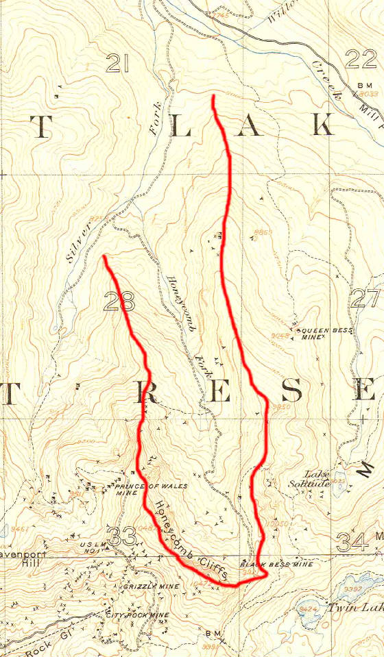
Detail of a 1907 USGS Topographical "Cottonwood Special Map"
showing the Honeycomb Fork area of Big Cottonwood Canyon. The red line has been added to show the approximate area and follows
the ridge lines between Honeycomb Fork and the surrounding forks. Note the number of mining locations on both sides of the
canyon at all levels. The fork terminates in a steep bowl just below the Honeycomb Cliffs. The only named mine in the fork
on this map is the Black Bess. THRP - Winegar Collection
WOODLAWN MINE