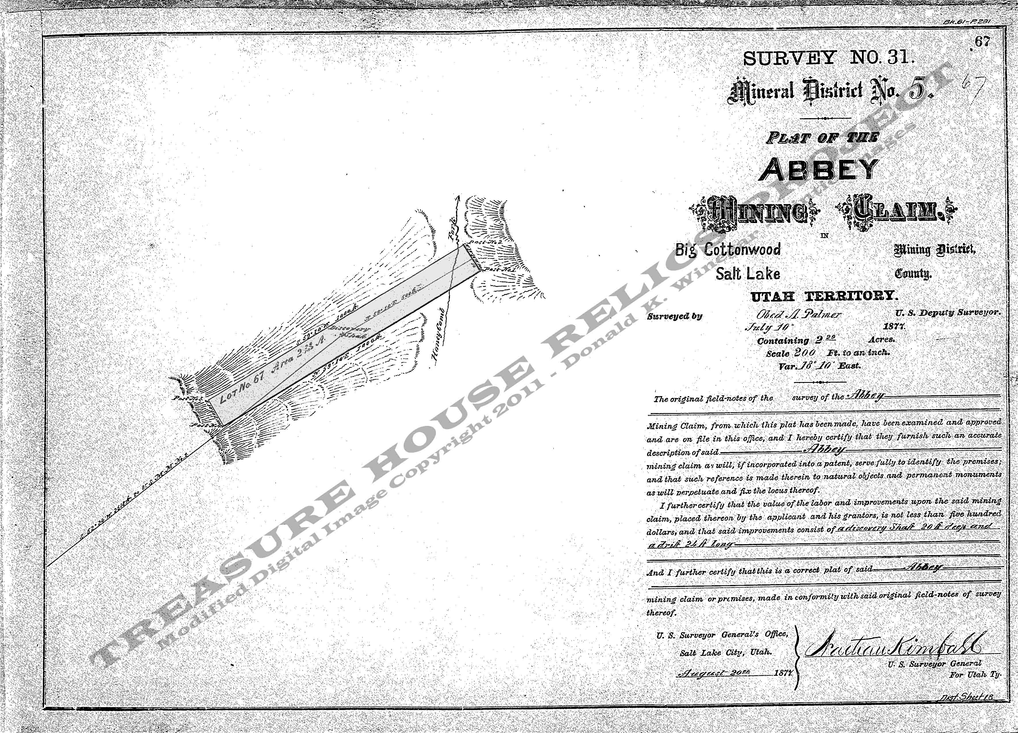
Mineral Survey Plat
Below is a copy of the Mineral Survey Plat for the Abbey Mining Claim,
Honeycomb Fork, Big Cottonwood Mining District, Mineral District #5, Survey #31, Lot #67, Dated July 10, 1877. The original
claim was 100 feet wide and 1000 feet long, running south-west to north-east and encompassed 2.29 acres of ground.
The Discovery shaft was centered
on the claim, but no other structure information is listed.
Base Plat is from originals scans by the U.S. Department of the Interior, Bureau of Land Management (BLM).
Modified
digital map image Copyright 2011 - THRP - Tintic Images
