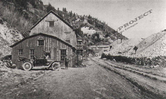
View
of the Maxfield mine surface workings along the Big Cottonwood Canyon road c.1904
THRP - Winegar Collection -
Tintic Images
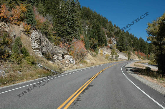
View
from below the old Maxfield Mine site along the Big Cottonwood Canyon road c.2005
Donald K. Winegar -
Tintic Images
Location data
QUICK LOCATION PATH: Utah / Salt
Lake County / Big Cottonwood District / Big Cottonwood Canyon / Mill A Gulch (North)
|
Approximate GPS Location:
|
40.38.552 N - 111.41.053 W (field) |
|
|
Approximate Elevation:
|
6967' (field)
|
|
|
30 x 60 Minute Map:
|
SALT LAKE CITY, UTAH
|
|
|
7.5 Minute Map:
|
MOUNT AIRE, UTAH
|
|
Mineral Survey Plat
Below is a copy of the Mineral Survey Plat for the Maxfield Lode Mining
Claim, Big Cottonwood Mining District, Mineral District #5, Mineral Survey #62, Lot #98, dated June 4, 1878. The original
claim was 200 feet wide, and 2168 feet long, running South-East to North-West and encompassing 8.84 acres of ground.
The Plat shows the discovery marker centered on the claim on the west slope of Mill A Gulch
(North). At the time of the survey, the Maxfield had two tunnels at different levels; one 300 feet in length, the other just
30 feet. The longer tunnel also had a 180 foot incline near the face. No structures are indicated on the plat, though many
would come later.
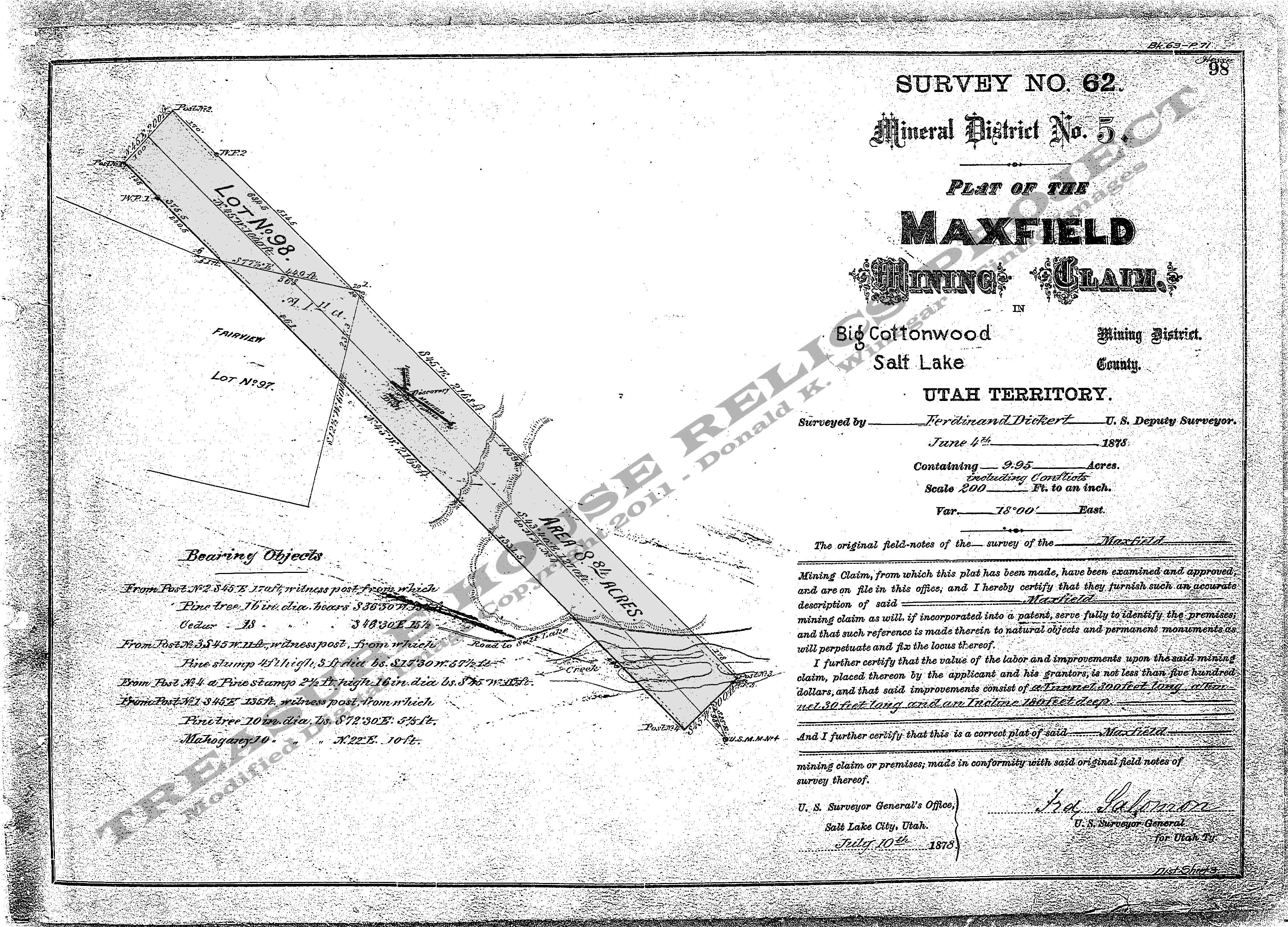
Base Plat is from original scans by the U.S. Department of the Interior, Bureau of Land Management (BLM).
Modified
digital map image Copyright 2011 - THRP - Tintic Images
What remains
Nothing. No structures remain standing at this site. Only water flowing from
the caved portal of the lower tunnel marks the site of the old Maxfield along the highway. Farther up the gulch to the left, small dumps from
several other prospect holes and the original shaft (also caved) can be found.
_____________________