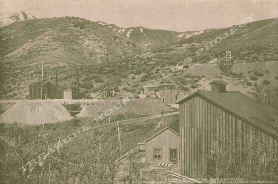
Hoist
house, ore bins, dumps and surface workings of the Golden Gate Mine c.1898 - THRP - Winegar
Collection
Location data
QUICK LOCATION PATH: Utah / Tooele
County / Camp Floyd District / Mercur or Lewiston Canyon / Mercur
|
Approximate GPS Location:
|
40.19.340 N - 112.12.306 W (topo) |
|
|
Approximate Elevation:
|
6963' (topo)
|
|
|
30 x 60 Minute Map:
|
RUSH VALLEY, UTAH
|
|
|
7.5 Minute Map:
|
MERCUR, UTAH
|
|
Brief history
The Golden Gate Mine was one of the smaller producers in
the early days of the Mercur boom. All that would change as rich ore bodies were found. The mine would become one of the biggest,
if not the biggest, in the district. The mine is more famous for the huge mill that was built to process all that precious
ore. The mine was also served by the Salt Lake and Mercur (Union Pacific) Railroad. (More coming)
Getting there
Mercur Canyon is closed to access at this time. The site of the original mine no longer exists. The land was
open pit mined by Barrick-Mercur and other companies and is now in the process of being reclaimed. Once the reclaimation work
is complete, it is not known if the old site will be marked or identified in any way.
What remains
Nothing.
______________________